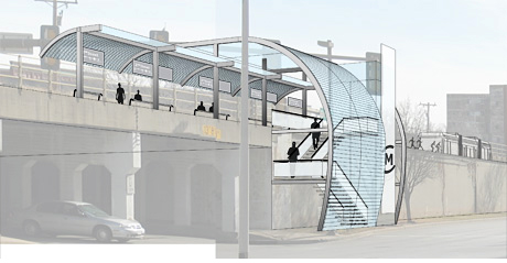
Street level view of the 2nd Street metro rail stop.
OKLAHOMA CITY METRO STATION
Oklahoma City is currently bifurcated by an elevated rail system. To the west of the line are the Business District, Arts District, Automobile Alley, and St. Anthony’s Hospital. To the east lie the State Capitol Complex, the Health Science Center, the Flatiron District, Deep Deuce, and Bricktown. All of these areas are undergoing intense redevelopment efforts; however, there is no thread connecting these disparate districts. The proposed tramway and station stops would revitalize an existing infrastructure to stitch these areas together and assemble the separate districts of Oklahoma City into a cohesive urban fabric.
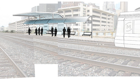
Track level view of the 2nd Street metro rail stop.
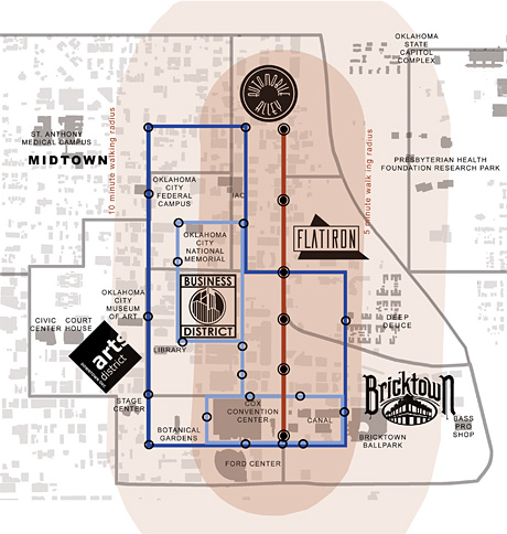
Map of metro transportation routes. Blue lines represent existing bus route lines, the single red line signifies Phase One of the MetroRail tramway project.